AVENZA OFFLINE MAPPING APP
Follow the link below to download the Avenza Offline Mapping App on your phone, so you will always be able to see where you are on the map!
This application is free and works on all iPhone and Android devices.
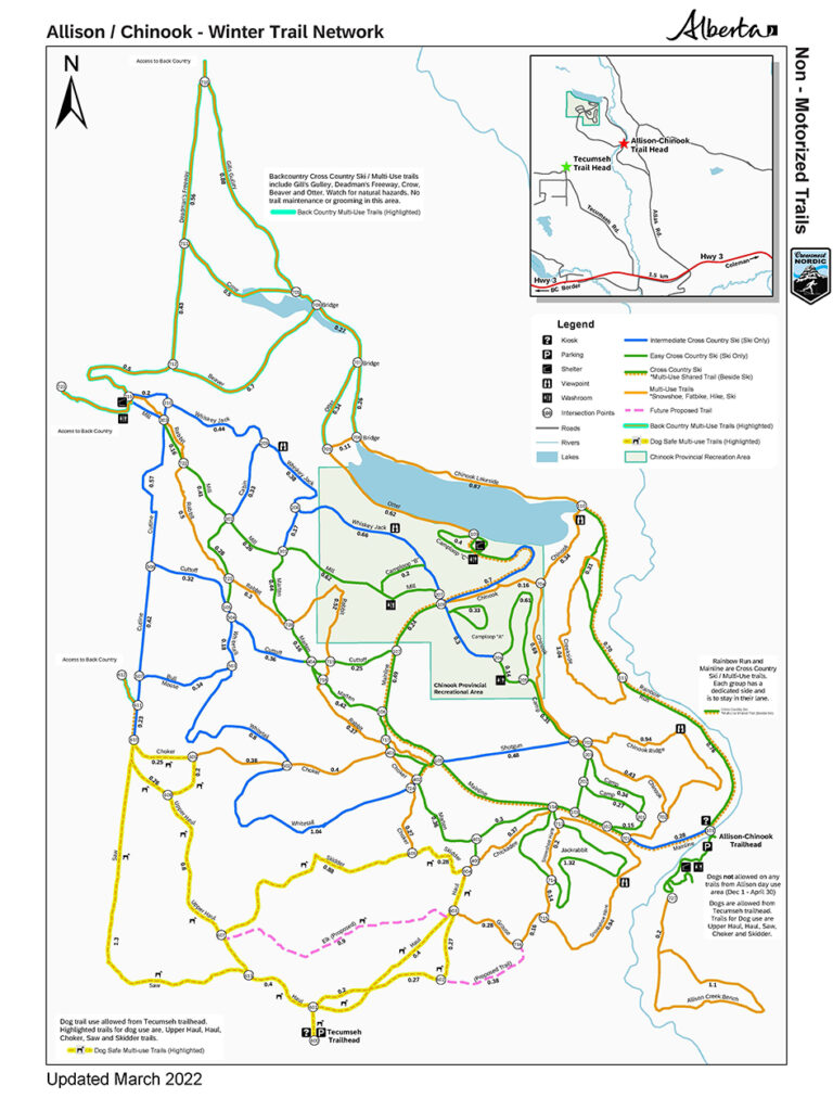
Once you have downloaded the app to your phone, open the geo-referenced Trail Map PDF map above, to download it to your phone. In Avenza Maps, click on the “+” sign to import the map from your device into Avenza. On the trails, when you open the app and select the Allison-Chinook map, there will be a dot on the map at your location. You can also pull up a menu to “Record GPS Tracks”, as well as other mapping functions. Maps for Castle Park and Livingston PLUZ area also available for use with Avenza.
VEHICLE DIRECTIONS
For vehicle directions to the Main Ski Trails: follow the directions on Google Maps to the Allison Creek Brood Trout Hatchery and park outside the gate. Or follow the directions below.
TRAIL ETIQUETTE
Please observe the following trail etiquette and we can all enjoy the area safely:
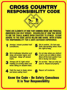
- Read and understand the “Cross Country Responsibility Code” on this page.
- No motorized vehicles are permitted on any of the posted cross country ski trails.
- Maintain the classic ski tracks by not skate skiing, walking, or snowshoeing on them.
- No dogs are allowed December 1 to March 31 except at the Dog Friendly Trails accessed from its separate parking area. Please see the map for this information. Absolutely no dogs are allowed to access trails from the main parking area.
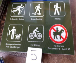
With so many more people using winter trails, conflicts between different user types made it necessary for the CNSC to adjust our thinking to welcome snowshoes, fat bikes and hikers to the winter trails at Allison. We created new trails to reduce user conflicts, and have installed AB Parks trail use signs that indicate the type of activity you can do on a particular trail. Please respect all users by obeying these trail use signs, so everyone can enjoy their winter activity on the Allison Chinook trails. You will see the new trail use signs and maps throughout the Allison trail system.
The map shows the new multi-use trails, marked with orange lines. These trails can be used by snowshoers, fat bikers, winter hikers and skiers. Mainline trail and Rainbow Run trails are shared use trails and are groomed for skiers on one side and all other winter users on the other. Signs clearly designate which side to use and we thank you for obeying these signs.
DOG FREINDLY
You will see this trail use sign on the orange multi-use trails on the map. You can ski, snowshoe, hike or ride a fat bike on these trails. CNSC volunteers spent hundreds of hours making multi-use trails for your activities and enjoyment. Please respect other users by obeying these signs.
Allison Creek Bench, Creekside, Rabbit, Otter, Chickadee and the edges of Mainline & Rainbow Run are machine packed for fat bikes. The rest are user packed.
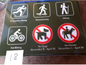
MULTI USE
You will see this sign on the Tecumseh dog friendly trails. Dog friendly trails are highlighted in yellow on the map and dogs are welcome on these trails year around.
Please, no dogs on the rest of the trails after Dec 1. Dog friendly trail boundaries will be clearly marked.
Please respect other users by obeying these signs.
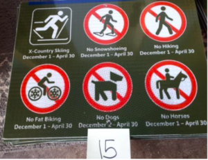
SKIER ONLY
Ski only trails are marked with green or blue lines on the map. These trails are groomed for classic skiing and for skate skiing where possible.
You will see this sign on “ski only” trails. If you are snowshoeing, hiking or fat biking, please do not use these trails. Remember, ski trails are groomed wide enough to accommodate both classic and skate skiing.
You may think there is room for snowshoeing, hiking or fat biking on the trail edge, but doing so ruins the groomed trail for skiers. The divots you make on the trail surface make skate skiing or snow plowing difficult and dangerous for skiers. It also reduces skier enjoyment at Allison. Please respect skiers by obeying these signs.