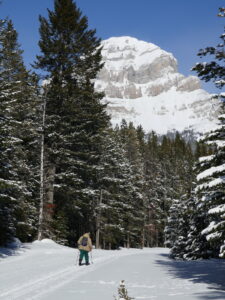
Allison-Chinook Ski Trails
We are pleased to offer a ski trail map for download, both as PDF and GPX files:
 Follow the link below to download the Avenza Offline Mapping App on your phone, so you will always be able to see where you are on the map!
For vehicle directions to the Main Ski Trails: follow the directions on Google Maps to the Allison Creek Brood Trout Hatchery and park outside the gate or see the following instructions:
Main Parking Area (no dogs allowed):
- Driving west on Hwy 3, turn right on to Allison Creek Road at:
- 8.6 km west from the Tim Horton’s/Shell gas station next to the highway at west Blairmore, or
- 2.3 km west from the highway speed change back to 100 km/hr at the west end of Coleman.
- Driving east on Hwy 3, turn left on to Allison Creek Road at:
- 9.6 km from the BC/AB border.
The Dog Friendly Trails Parking Area:
- Driving west on Hwy 3, turn right on to Tecumseh Road at:
- 10.1 km west from the Tim Horton’s/Shell gas station next to the highway at west Blairmore, or
- 3.7 km west from the highway speed change back to 100 km/hr at the west end of Coleman.
- Driving east on Hwy 3, turn left on to Tecumseh Road at:
- 8.1 km from the BC/AB border.
Click on the Avenza logo below to link you to the app download page. This application is free and works on all iPhone and Android devices.

Once you have downloaded the app to your phone, open the geo-referenced Trail Map PDF map above, to download it to your phone. In Avenza Maps, click on the “+” sign to import the map from your device into Avenza. On the trails, when you open the app and select the Allison-Chinook map, there will be a dot on the map at your location. You can also pull up a menu to “Record GPS Tracks”, as well as other mapping functions. Maps for Castle Park and Livingston PLUZ area also available for use with Avenza.
")


